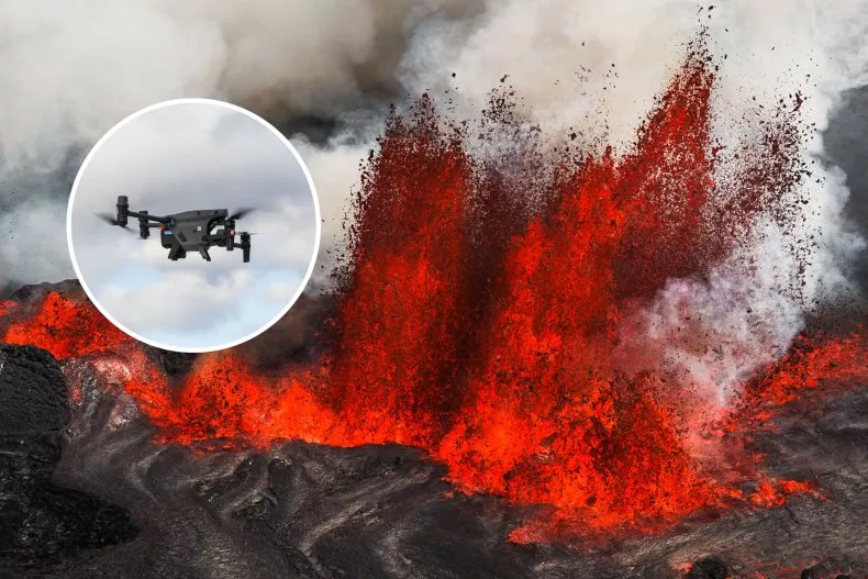
A new video has highlighted the crucial role of drones in Icelandic authorities to avert disaster and protect people and property following recent volcanic eruptions in the southeast of the country. These drones are part of the Icelandic Civil Protection Drone Unit, which is used to avoid damage to infrastructure when volcanoes erupt. The video highlights how the DJI Dock drones act like eyes in the sky, giving authorities live updates on the precise location of eruptions, the direction of the lava, and the rate of lava flow.
Drone data collected can show the direction volume and speed of the lava, which helps other departments make better decisions such as turning off power lines or building more defense walls. The thermal camera allows authorities to see which lava is old and which is new, as well as find lava pools and check whether the defense walls are in good condition to keep the lava away from critical infrastructures.
The drones are also being used to help warn local residents of an eruption. The 4,000 people who call Grindavik home have been evacuated multiple times as the volcanoes erupted. Footage in the video shows how rivers of lava flooded into the town’s outskirts, destroying roads and burning down several houses. The video also shows how drones are faster than their UAS mobile teams, so it is very important to get the drone up in the air as fast as possible.
Arnar Thor Egilsson, chief inspector at the National Commissioner of the Icelandic Police, said that drones have never been as important as now to keep the community and first responders safe. The video shows how the DJI Dock drones act like eyes in the sky, giving authorities live updates on the precise location of eruptions, the direction of the lava, and the rate of lava flow.