Astrophysicist Neil DeGrasse Tyson published a viral post on X, revealing that Florida and much of America’s East and Gulf Coasts would be consumed by water due to climate change. The post went viral, with many questioning the truth of the projection or climate change itself. Tyson’s map appears to be lifted from the September 2013 issue of the National Geographic, which considered what different continents would look like if all of the world’s ice melted, causing 216 feet of sea level rise.
David Thornalley, a professor of ocean and climate science at University College London, said this was “an extreme example” that would happen if we didn’t take steps to reduce our greenhouse gas emissions. In the long term, sea level rise after a few hundred years is expected to be in excess of 10 meters [33 feet].
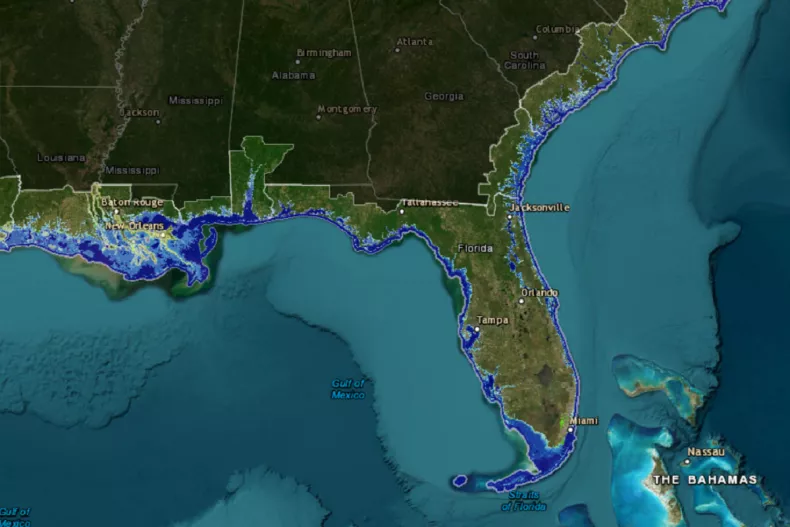
By the year 2100, the Intergovernmental Panel on Climate Change (IPCC) estimates there will be between 43 and 84 centimeters (1.4-2.8 feet) of sea level rise, but an increase of two meters (6.6 feet) “cannot be ruled out.” According to projections made by the National Oceanic and Atmospheric Administration, the sea would still engulf a significant portion of Florida’s coastline at a sea level rise of about three feet.
Different ice sheets have differing levels of vulnerability to melting, with the most at risk being those parts of the Antarctic ice sheet that are marine-based. Antarctica’s ice sheet holds enough water to raise sea levels by over 190 feet, and Greenland’s ice sheet could be completely lost within the next 1,000 years.